W SERIES APPLICATIONS
REMOTE MAPPING APPLICATIONS
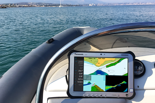
WIRELESS MAPPING FROM TENDER – W3
Using a Tender, you can quickly generate your own up-to-date and trusted bathymetric map to safely navigate the mothership to the best anchorage for the day. You can also follow the Tender as it goes through tricky waters to make sure you avoid any hidden obstacles, averting possible damage. With Backscatter, you can understand the seafloor hardness to ensure you use the correct anchor.
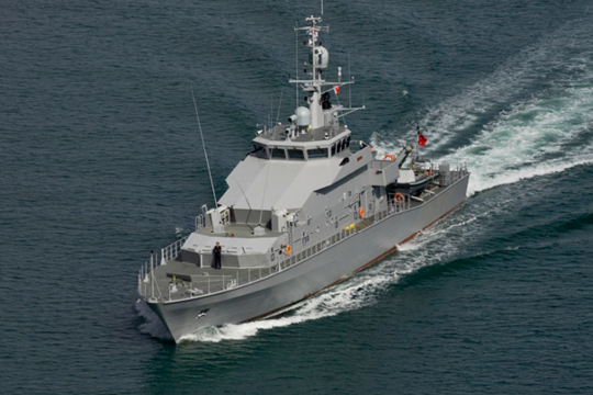
DEFENCE – W3
With the WASSP W3, you can easily identify damage to the seafloor following a natural disaster. You can map an area extremely quickly to assess conditions so you know when and where it’s safe to proceed. Search and rescue vessels can locate bodies, dropped tools or equipment, discover artefacts or find unexploded bombs with far greater efficiency.
EXPLORATION – W3
f you’re exploring new territory, many areas that are
off the ‘beaten track’ won’t have been mapped in years,
decades, or may use charts based on surveying from the
beginning of the British Admiralty. This means you can only trust maps you generate yourself to ensure your safe passage. With the W3, you can get a 3D image of a rock or wreck you may wish your guests to dive on, or navigate a submarine or Remote Operated Vehicle (ROV) around. Plus, it’s the ultimate fish finder for a fishing trip to somewhere no one else has fished before.
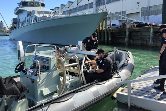
RAPID DEPLOYMENT – W3
While a fixed transducer installation in your Tender is most ideal, this is not always possible. In these cases, you can use a WASSP carbon fibre mast that includes the transducer, motion sensor and satellite compass that is light and quick to deploy as and when you need it. In an open vessel, the DRX Processor can be installed in a Pelican case to protect it from water damage.